- Home

- Blog
- Hannah Clarke & Jacob Duce
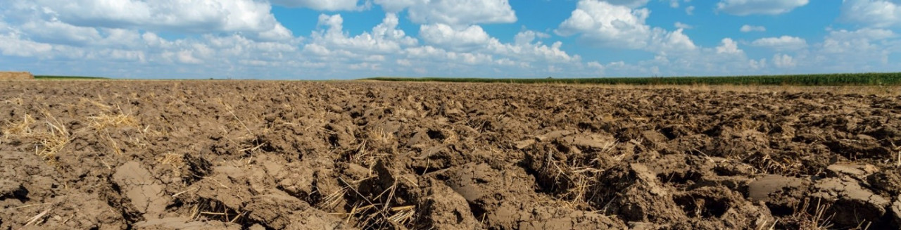
- Environmental Land Management blog series: 2/ Drawing a line in the sand and building a baseline of your soils
Environmental Land Management blog series: 2/ Drawing a line in the sand and building a baseline of your soils
This blog is the second to be published as part of our Environmental Land Management blog series. Our first entry covered some of the common questions we get from growers about the Environmental Land Management schemes (ELMs) and the Sustainable Farming Incentive (SFI) specifically, as well as opportunities linked to Countryside Stewardship. You can read it here.
If we touch back on the SFI, which is the first scheme to be launched as part of ELMs, you may be familiar with the three standards (plus a review) that it encompasses for 2022. You can find them here if you are unfamiliar.
On the 30th March this year, DEFRA published more guidance around the SFI standards and made specific mention of the arable and horticultural soils standard, stating that it will "encourage actions that improve soil health."
What is the arable and horticultural soil standard?
The following actions are included in the standard:
- Action 1: Complete a soil assessment and produce a soil management plan
- Action 2: Test soil organic matter
- Action 3: Add organic matter to your soils
- Action 4: Achieve 70% overwinter cover.
There are two different levels available within the standard; introductory (£22/ha) or intermediate (£40/ha). The difference between the two is that for action 3 (add organic matter to your soils) within the intermediate level, the soil will need to include some type of multi-species green cover. For action 4 (achieve 70% overwinter cover) within the intermediate level, 20% of the overwinter cover will also need to contain multi-species green cover.
SFI requires you to undertake measurements and actions as set out above and these should result in improvements to soil health over time. To be able to monitor these areas and make improvements, we highly recommend 'drawing a line in the sand' to understand what you currently have in your toolbox - thus supporting management decisions as you move forward within your scheme. It is very difficult to measure improvement if you don't know where you started from.
SOYL's precision crop production team provides a host of services that can support you with benchmarking your farm so you can measure the improvement of your soil over time. Some of the services are outlined below.
Organic matter
Building soil organic matter (SOM) content is no easy feat and can take many years. Sampling for SOM gives you a benchmark that you can use to quantify the success of your management practices and the organic matter inputs you are adding to your soils. It is also a good indicator of how well your soils will both retain moisture in dry spells but also process excess water in wet spells and allows you to gauge their overall functioning. Generally, the higher the SOM the better functioning and more resilient the soil will be providing better growing conditions for your crop.
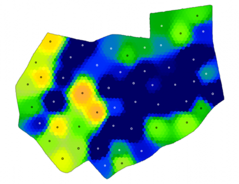
P, K, Mg, pH
Measuring the nutrient levels of your soils enables you to tailor fertiliser recommendations to meet your crop's requirements. There can be areas where you may reduce applications but also areas where increased application levels may be required to prevent limited crop performance. Understanding the bank of nutrients in your soils will pay dividends now more than ever given the cost of fertiliser inputs. SOYL's advisors can create a custom sampling package to suit your business but as a standard, we would recommend a one hectare-grid strategy to maximise the data collection opportunity and accuracy.
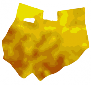
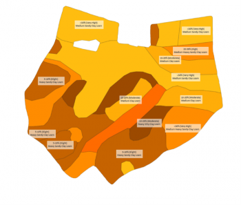
Soil textural classification
Soil textural classification
Texturally classifying your soils gives you a wealth of information, enabling you to create both a detailed soil assessment plan and a soil management plan. Members of our SOYL sampling team scan your land using an electro-conductivity scanner (EC) which measures the water holding capacity of the soil and in general, the greater the holding capacity, the heavier the soil. Our team then uses this EC scan data as a GPS, guiding us to each soil type zone so that we can texturally classify it to create a soil type map. This includes the topsoil, sub soil and stone content. This data can also be used for variable rate drilling.
Summary
Determining and building a baseline of your soils is vital and using the above services can provide you with a wealth of information that will support your future decisions. Knowing what you've got and where you started is fundamental to tailoring an approach and measuring change over time.
For more guidance on SFI standards or if you'd like to find out more about the services available from the SOYL team, please speak to your local SOYL representative or contact us.
We'll be sharing more advice on ELMs and Stewardship as part of this blog series, with the next post focusing on digital solutions for the schemes, such as our environment manager tool and the new MySOYL mobile app. Subscribe here and you'll be notified once it is published.

Hannah Clarke
Kings Technical Advisor
Jacob Duce
Assistant Commercial Manager

As a subscriber, you’ll receive email alerts each time a new blog is published so you can always stay updated with the latest advice and insights from our experts
Comments